Home » Travel_Spot_Around
Category Archives: Travel_Spot_Around
भटकंती 9 Days (Aurangabad,Junnar)
Solo Trip long awaited dream of mine & as it was the first solo trip, so I decided to visit places in Maharashtra only on bike with full bag packing. This blog is quite lengthier as it’s my 9 days trip, but then also intersting & helpful to catch your small small dream which might be same as mine. The round trip I planned was given below,
Pune –> Devgad –> Aurangabad Panchakki –> Bibi Ka Maqbara –> Aurangabad Caves –> Soneri Mahal (Museum) –> Deviri Fort –> Bhadra Maruti Temple –> Grishneshwar Temple –> Ellora Caves (34) –> Vetalwadi Fort –> Ajanta Caves (30) –> Antur Fort –> Goutala Forest –> Shirdi –> Chawand Fort –> Naneghat –> Jivdhan Fort –> Kukadeshwar Temple –> Harishchandragad –> Pune.
As I was born & brought up in Jalna City next to Aurangabad, I have huge friend circle there, who can help me in stay and food . But I wanted to live fully outside as traveler, not as luxurious but as भटका so I haven’t informed any of them & started my trip on 23rd December 2016 Friday night at 11:30 PM from Pune.

Bag Packing done as given below,
- Rider carry-out (leather jacket, hand gloves, helmet, jungle shoes, buff, chain lock and goggles).
- Sleeping Bag.
- Two hiking walking sticks.
- Water bottle, Glucose carried in vessel & coffee.
- Extra Sweater, Stole, Pair of Cloths, Slipper.
- Few cooking bowls.
- Daily washing things.
- Tent, Trekking Bag.
- Two Flexible Ropes.
- DSLR
- Power Banks, Torch & Charger also
- Some basic information about the places going to visit.
Helpful things I want to share with you are, if you are planning for any such bike trips, first while riding make sure of your full safety, second whatever things you are carrying tie that on bike properly using those flexible ropes because of this you will avoid extra exertion while riding, carry light weight things on such trips.


I reached the 1st destination i.e. Devgad at 5:00am, after traveling 200Km from Pune with small small naps in between for rest. There I found yatri niwas to stay but I enquired them I have all things with me so can place it on one side of ground, they allowed me. It was too cold out there, more because of Pravra River flow. So I arranged all my things within few minutes & went to sleep suddenly in my cozy cozy sleeping bag. After taking rest for 4 hours I woke up & got fresh in washroom available there for tourist (very neatly maintained). If you want to book rooms there then you can easily do that by visiting there site or on phone calls.
The scenery around temple was amazing; I took darshan at Datta Mandir & had meditation for 15 minutes inside the temple. The feeling was simply awesome, as I was easily able to concentrate because of no pollution (noise, air, crowd, etc.) or I can say disturbance. As it was Saturday that day, I did Hanuman Chalisa prayer at Hanuman temple & went to the holy river Pravra via series of steps lending down there called as Ghat. Then after I started my photography, had some beautiful snaps & went out of temple. I used to have fast on every Saturday so I preferred for fruit breakfast that day. Now don’t laugh, I went to the fruit store had 6 slices of pineapple, eat one whole watermelonJ & at last had one sugar cane juice. While completing all this stuff it was already 12 noon in clock & further I need to travel 50 more kilometers to reach Aurangabad. So after my heavy breakfast I directly went to the Panchakki, one of the tourist places there.

Panchakki – Water Mill To Grind Grain.
So many years back and Russian Muslim Baba Shah Musafir a Sufi prayed for water and got it from the hills about 7 kms away to this place. This water mill was used to grind grain for the pilgrims and disciples of saints as well as for the troops of the garrison. The panchakki is located inside a dormitory for poor people (in those days, now it’s only a tourist attraction). One can see the water flowing, the turbine of the water mill and the original chakki (grinding stone) which has worn thin but still rotates by the turbine. The mausoleums of the Russian fakirs who built it and the dormitories and some of their original vessels/clothes etc can be seen in the museum. Also I experienced the natural AC at their tomb. At around 2:30PM I reached the Bibi Ka Maqbara.


Bibi Ka Maqbara
The Bibi-Ka-Maqbara is a beautiful mausoleum of Rabia-ul-Daurani alias Dilras Banu Begum, the wife of the Mughal Emperor Aurangazeb (1658-1707 A.D.). This mausoleum is believed to be constructed by Prince Azam Shah in memory of his mother between 1651 and 1661 A.D. An inscription found on the main entrance door mentions that this mausoleum was designed and erected by Ata-ullah, an architect and Hanspat Rai, an engineer respectively. The marble for this mausoleum was brought from mines near Jaipur. According to Tavernier, around three hundred carts laden with marbles, drawn by at least 12 oxen were seen by him during his journey from Surat to Golconda. The mausoleum draws its inspiration from the world famous Taj Mahal of Agra (constructed between 1631 and 1648 A.D.) and hence it is rightly known as the “Taj of Deccan”. The mausoleum was intended to rival the Taj Mahal, but, the decline in architecture and proportions of the structure had resulted in a poor copy of the latter. Even this decline cannot stop one appreciating the setting of the tomb complex in a garden setting with the mountain ranges behind providing as a backdrop. A huge ‘U’ shaped gap in between the hills behind provides the perfect harmony in which the mausoleum is blended. After having some snaps there I left for the next place in my list.

Auragabad Buddhist Caves
The Aurangabad caves are located on a hill running roughly east to west, nearly 2 km behind Bibi-ka-Maqbara. In all twelve Buddhist Caves are found here which fall into three separate groups depending on its location. The first group consists of caves 1 to 5, the second 6 to 9 and third 10 to 12. The caves are datable from circa 2nd – 3rd century AD to 7th century AD. The first and the second groups are separated by nearly 500 metres from each other, with the former at the western side while the latter is on the eastern side of the same hill. The third group is further east of the second group. Here I took some rest & had some carrots again & went to the Soneri Mahal Museum.


Soneri Mahal Museum
The golden palace is situated on the outskirts of the main Aurangabad city, inside the campus of the B.R. Ambedkar Marathwada University. This building made of stone and lime has wild luxuriant pastures, which add to its grandeur. The palace gets its name from the paintings made in pure gold water which adorn its interiors. Soneri Mahal is now a State Protected Monument. This monument has lots of archeological things collected from different parts of Maharashtra. I loved the stone writings present over there, seriously that much clear & neatly I haven’t written on paper also. Then around 4:30PM I reached the Devgiri Fort.


Devagiri Fort
Devagiri fort is also known as Daulatabad. It is a 12th-century fort city in Maharashtra state of India. It is also considered to be one of the seven wonders of Maharashtra and a developing tourist spot. A series of secret, quizzical, subterranean passages lie coiled like a python amidst the fort. Here flaring torches were thrust upon an unwary enemy. Or hot oil poured down his path, as he deliberated in the labyrinth. Also the heat from a brazier was blown into the passage by a process of suction suffocating the entire garrison within. The Fort itself lies in the body of an isolated hill; the steep hill – sides at the base falling so sharply to the moat that no hostile troops could scale the height. The moat, 40 ft. deep and carved into solid rock with mechanical drawbridges teemed with crocodiles. A 5-kilometer sturdy wall, artificial scarping and a complicated series of defenses made Daulatabad impregnable. The 30-meter high Chand Minar (Tower) built much later with 3 circular galleries had a defensive and religious role in the fortress. Now a days’s one saint samadhi prayers used to happen there so too much rush & crowded place.
As I am trekker so I considered that I can see this fort during night time also & I planned my schedule as per that but due to rush & fort closing time at 6:00PM I got only two and half hours to experience the beauty of Deccan(Devagiri Fort). All the above places have opening time as 9 AM & closing time as 6 PM, plan according to that. If you are fort lover then you need full one day for devagiri fort, reserve it according to that.
To end the first day I went to the Bhadra Maruti Temple.
Bhadra Maruti Temple, Khuldabad is a temple dedicated to the Hindu deity Hanuman, located at Khuldabad, near Aurangabad, Maharashtra. The temple is located four kilometers from the Ellora caves. At this temple, the idol of Hanuman is portrayed in a reclining or sleeping posture. It is one of only three places where Hanuman is represented in a sleeping posture. The second noted place is a temple on the banks of Yamuna at Allahabad and Uttar Pradesh and the third is at Jam Sawali, Madhya Pradesh. There I had my full dinner at bhojnalay in only 25Rs & if you want then you can book rooms at bhakta niwas to stay but I went to verul.

After this hectic full day visit at so many places, I stayed at one aged villager’s house. Next morning woke up early, packed up all my things & had darshan at Grishneshwar Temple, it’s one of the lord shiva jotirlinga in India. Then I went to the one the most awaited place for me & that is ellora caves. I already reserved the whole day for those caves only, all together 34 caves are there, divided in three groups 1. Hindu Group of Caves 2. Buddhist Group of Caves 3. Jain Group of Caves. These three groups can be further termed as three periods, which sustained from 200 – 600 AD (Buddhism) to 500 – 900 AD (Hindu) and finally 800 – 1000 AD (Jain). Every year, Ellora festival of classical dance and music is organized at these caves by MTDC. The Ellora caves locally known as ‘Verul Leni’ & is located on the Aurangabad-Chalisgaon road at a distance of 30 km northwest of Aurangabad. The name Ellora itself inspires everyone as it represents one of the largest rock-hewn monastic-temple complexes in the entire world. Ellora is also world famous for the largest single monolithic excavation in the world, the great Kailasa (Cave 16). The caves are hewn out of the volcanic basaltic formation of Maharashtra, known as ‘Deccan Trap’, the term trap being of Scandinavian origin representing the step like formation of the volcanic deposits. The rock formation, on weathering has given rise to the appearance of terraces with flat summits. At Ellora, one can also have a glimpse of the channels through which the volcanic lava once flowed.

Buddhist Caves Amongst the 34 cave temples, 12 temples (Cave 1 to 12) belong to the Buddhist period. These temples have incorporated themes of Hindu and Jain, which suggests the deliberate waning of Buddhism. These caves trace their origin in the Mahayana phase of Buddhism and comprise many really striking images of Buddha.
Built somewhere during 550 – 750 AD, the caves are decorated with carvings, paintings, sculptures and murals depicting the life of Lord Buddha. Cave No. 10 and 12 are regarded as the important ones. The former presents typical example of Chaitya architecture and got its name from Vishwakarma (the divine architect). Cave 12 is known for its magnificent three-story structure.
Hindu Caves Following Buddhist Caves, there are 17 caves (Cave 13 to 29) that embrace Hindu temples. Constructed somewhere during 600 – 875 AD, the Hindu caves are entirely imprinted with carvings and sculptures of apsaras, tree nymphs, animal motifs, trees, plants, gods and goddesses. One can see intricately carved pillars that are massive, but sited proportionately to accord with the size of caves. Several pillars are plain and lack carvings; however a larger number have carved bases, brackets and grooved shafts. Cave No.16 comprises the Kailash Temple that is known to have the largest monolith structure of the world.
Jain Caves After Hindu Caves, there comes the number of Jain Caves. Built between 800 AD and 1000 AD, five caves (Cave 30 to 34) belong to the Jains. Again the caves are adorned with images of the Lords and various mythological pictures.

Architecture Ellora Caves present a wonderful example of cave temple architecture. The world heritage site of Ellora, has detailed fascia in the company of elaborate interiors. The main patrons of Ellora cave temples are assumed to be the Chalukya – Rashtrakuta rulers (7th – 10th century). In those times, many king and merchants contributed huge sum of money for the erection of these temples. The construction of these temples was believed to provide salvation (moksha) to the Kings. Ellora Cave temples took around five centuries to seek completion. Wholly carved by Buddhist, Hindu and Jain monks, the temples appear astonishing in the golden light of the Sun. Ellora Caves boast of the outstanding imagination and detail work of art in the shape of their ancient monasteries, temples and chapels. The exquisite carvings have glimpse of Buddhism, Hindu and Jain expressions. Exhibiting the ingenious excellence of the artists, the caves are adorned with wooden beams, graceful angles, steps along with divine figures of gods and goddesses. Ellora Cave has preserved beautiful wall paintings of the bygone era. Around 5 caves possess such paintings, but the best preserved lies in Kailasa Temple. According to the archeological revelations, the paintings were made in two phases. The paintings that belong to the first phase usually portray Lord Vishnu and Goddess Laxmi. In the later phase, the masterpiece is that of a procession of Shaiva, the holy men. The paintings also illustrate beautiful ‘Apsaras’ in a graceful flying pose.

Note:
- Ellora caves are closed on every Tuesday for maintenance.
- All this information collected from different different sites on internet.
- First see the Kailas Temple & head towards the Buddhist caves, after that from left side of kailas temple go upside few Hindu caves are there bit slipper in rainy season need to be careful. At last there is hindu goddess temple & small lake, avoid going into the water ponds. From top of that hill I headed towards the jain caves & finally while coming back to main entrance I saw remaining hindu caves. In this way in 7 to 8 hours I completed scenic views of Ellora caves.
- The distance between Kailas Temple & Jain caves is little bit longer so if you want you can go by bus; in that case you will miss some Hindu Caves. I visited all caves by walk only.

Around 4 PM I had my lunch at Vrindavan Hotel just opposite to the parking place. As it was too late to go at Ajanta caves, I decided to go at Vetalwadi fort. I reached to base of that fort at 7:00 PM, as I was not aware about the route of fort & its dark outside also most disturbing thing I faced here was local villagers are not helpful for route & all. Few of them are not even aware about the fort also, rather than helping me they doubted me, so I decided to go on some nearby lodge for night stay & in the morning I will visit the Vetalwadi fort & Ajanta Caves.In this way day two ended.
Next morning I woke up early, freshen up quickly, took bath & had breakfast at nearby hotel. Then I went to the Vetalwadi Fort is situated in Aurangabad district near Soygaon taluka. Its solid and huge fortification, bastions and buildings are still in a good condition, which easily grab trekkers’ attention and gives a feel of a complete fort. The Halada Ghat directly takes us to the entrance of the Vetalwadi fort. This entrance welcomes us with the 2 huge bastions with another huge bastion behind it, which are constructed to attack the enemy entering. It also has decorative balustrade. The paved route between these 2 bastions turns in right angle and goes to the north facing entrance door. This door is said to be also called as Janjala Darwaja as it faces the Janjala fort. The bastion’s height is around 20ft and it has 2 Sharabh sculptures on it. There are also has porches for guards. There is a staircase which routes to the square shaped opening on the roof of main door. The stairs from this opening take us to another chamber. From this top point, we can see the fort walls, Halada Ghat & the Vetalwadi Dam below. On the upper side we can see the fortification of the citadel.

Down the entrance door, on the right side is a dry cistern with pillars. The trail to the right from entrance takes to another big bastion, which is a host for bats today. After walking some distance we reach to the east facing bastion. Further 5 minute walk takes us to the citadel of the fort. Near this bastion of the citadel, there is a small dome shaped building which has small opening in the roof through which we can reach the middle bastion. There is a cistern near this bastion called “Tel-Tupache Taake” literally meaning the cistern for oil / ghee. Besides this oil tank we can see a granary, in front of which there are remains of a building. Ahead there is a mosque named “Namajgir”, on the walls of which we can see the carved signature of Nizam and a cross below it. In front of Namajgir there is a pond and to the right is a tomb.
To the northern point of the fort there is a building named “Bardari” which has 2 distinct arches. On the way to Bardari, there are some remnants. In Bardari we can find 2 rows of arches. It is said to be built for the royal family to spend leisure time. There is a similar mansion on the Deogiri fort too. Below the Bardari we can see the main entrance and Vetalwadi village.


We can reach the main entrance or the north facing entrance by a trail from Bardari. On the way, we can see a canon of about 6’10” in length. There is a secret door in the fortification. This entrance is guarded by two bastions and one of its doors faces north. Height of the door frame is about 20 feet and there are two Sharabhs carved on two sides. There are porches for the guards inside and the second door faces west. From this, it takes almost 20mins to reach to the Vetalwadi village.
It took only an hour to see all these places on fort & after that I marched to Ajanta caves & my bad luck on every Monday Ajanta caves are closed for maintenance; one can have only the outside view of caves from opposite hill. I said ok I will have that view only, after parking vehicle everyone need to catch the MTDC bus to go at actual cave place, max to max 15 min travel.

In the early 19th century, the long buried Ajanta Caves were discovered unknowingly by a British Army Officer. At this juncture, the beautiful sculpted caves that were lying deep within the Sahyadri Hills, above the Waghur River, came into the sight. The cave temples are sited in a horse-shoe shaped cliff, where Waghur is flowing at the bottom. Waghur River falls from a height of 200 feet, consequently making a series of waterfalls. The thud of these waterfalls can be easily noticed in the Caves.
Cut out of rocks, Ajanta Caves trace their origin between 2nd century BC and 6th century AD. Ajanta Cave Temples are dedicated to Lord Buddha. Not less than 30 in number, these caves used to make the lodging of followers and students of Buddhism. During the time of their stay, they adorned the caves with their outstanding architectural skills and artistic paintings. Generally, the carvings and the paintings illustrate the life stories of Lord Buddha. In conjunction with this, numerous styles of human and animal figures are also engraved in the rocks. The pictorial carvings and murals at Ajanta depict the modern society of those times. The artistic sculptures presented every kind of populace from kings to slaves, from men to women, from children to beasts along with flowers plants, fruits and birds. There are some figures that portray the inhabitants like ‘Yakshas’, ‘Kinneras’ (half human and half bird), ‘Gandharvas’ (divine musicians) and ‘Apsaras’ (heavenly dancers). All the thirty caves are divided into ‘Chaitya-Grihas’ (stupa halls) and ‘Viharas’ (dwelling halls). In order to reach each cave, one has to flight of steps that are preserved in their original structure. The Cave 9, 10, 19, 26 and 29 are known as ‘Chaitya-Grihas’, which were used for the worship of the Lord. The remaining caves are ‘Sangharamas’ or ‘Viharas’ that were used for the housing purpose of the followers and students of Buddhism. The caves are numbered as per their present access from the main entrance and were not erected in the same order. From artistic point of view, Cave 1, 2, 16 and 17 are really important and possess remarkable pieces of art that can certainly beat art of the modern world. The walls of these caves are adorned with murals that are maintained to provide the same charm and vibrancy of the bygone era. The wall paintings of the caves are made with the Tempera technique. This technique involves painting on a dry surface, after the wall is coated with 1 cm thick layer of a mixture made of clay, cow dung and rice husks. The painting is coated with a coat of lime on completion. In those times, the colors used to be natural. As per the facts revealed by Archeological department, the caves were carved out in two different segments, with a gap of more or less four centuries. The caves made in the first segment, date back to 2nd century BC whereas the caves of the second segment are said to have been made by the Vakatakas and the Guptas. Each cave comprises carvings and paintings representing the incidents of Buddha’s life, Bodhisattvas and the Jatakas.
Note:
- Ajanta caves are closed on every Monday for maintenance.
- All this information collected from different different sites on internet.
- If you are planning to visit Devgiri Fort, Ellora caves & Ajanta caves. Then visit any of the caves on first day then on second day devgiri fort & on third day other caves because too many caves almost 64 & that too in very large in size, so visiting both caves on alternate days may remove some excitement in you.
Because of previous days experience with locals I skipped night stay at fort Janjala, also few more forts on the way & directly reached to Nagad near Chalisgaon at one of my best buddies (Prasad Patil) home. As he was in Pune then also his parents served me like their own son, his mom made his favorite dish on that evening. We all eat it together & it was too cold out there, I asked them to have bonfire. While warming up there I had lovely talk with Patil Kaka & Kaku.

On my fourth day morning I had heavy break-fast made by Patil Kaku & one more time at Prasad’s uncle home. From there I went to the Antur fort. This fort was built about the middle of the 15th century by a Mahratta chief and named after him. It remained in the possession of his descendants for about a century and was then taken by the Mahomedans. Between the 16th and 17th centuries, it belonged to Nizam Shahi of Ahmadnagar, as may be gathered from several inscriptions, in which some of the kings of this dynasty are mentioned. A square stone pillar two miles south of Antur contains an inscription mentioning the direction of Nagapur and Jalna on the east, Mehawar and Chalisgaon on the west, Antur and Burhanpur on the north, and Daulatabad and Ahmadnagar on the south. It records the Hijri date 1000 (A.D. 1583), and states that it was erected during the reign of Murtaza Nizam Shah. A small masjid within the fort has a Persian inscription which mentions that it was built by Ismail Husain in Hijri 1025 (A.D. 1608). Another Persian and Arabic inscription on one of the fort bastions is as follows:- ” This lower wall was constructed during the reign and under the auspices of Burhan Nizam Shah, the fountain head of wisdom, by Malik Ambar, the wisest of the wise and benefactor of the world, in the year 1007 Hijri” (A.D. 1590). A later inscription upon a small arch within the second gateway is dated 1035 Hijri (A.D. 1618), and mentions that the arch was built by order of Malik Ambar.


To see all fortification, bastions, remnants, few water cisterns & some of the big big godowns which are under renovation now, one and half hour is more than enough. From there I left to Gautala bowl shaped hilly terrain with sprawling deciduous forests. There is a sanctuary spread over 269 sq. km. in Kannad & Chalisgaon tehsils of Aurangabad and Jalgoan district. Located on the Satmala hills, the sanctuary presents a picturesque panoramic view. The interiors of the jungle are impenetrable. Gautalas repute as one of the most enchanting picnic spots that has grown over the past few years. Gautala’s rapid waterfalls are a special attraction during rainy season. The Gautala sanctuary also encompasses ancient Buddhist cave temples popularly known as Pithalkhora. After spending some time there I started towards Narayangaon via Vijapur – Shirdi – Sangamner -Alephata. At around 8:00 Pm I reached at Shirdi so thought to have Sai Baba Darshan at famous shirdi temple, so after taking Mukha Darshan of Baba I went to Sai Prasadalay & had dinner there itself, till then it was 11:00 PM. Then also I decided to go ahead at my destination of that day. Seriously speaking it was too cold there, I was driving bike by wearing inners, thermals, t shirt, sweater, riding jacket, hand gloves, stole, buff, and helmet then also I was shivering. Before Alephata I saw one tea stall & guy over there getting warm on bonfire, so I thought to stop there for few minutes. I took one cup tea & get warmed there. After 15 minutes break I resumed my riding & again the same cold air started torturing me, this time without stopping anywhere I reached Narayangaon, there at Muktai Milk Parlor I had my favorite Masala Doodh it was just amazing. It was almost midnight around 2:00AM, so rather than heading to next place I asked to that Milk Parlor owner about lodge nearby, went over there & asked them I just want to sleep for till morning 6, they gave me common room bed & charged 70 RS. It was not so good but protected me from cold outside.
Next day morning I woke up at 6o’clock & after latrine I left the lodge. Because of water shortage I haven’t took brush & bath there, headed directly to Junnar from there via Aptale Road I reached to Chawand Village. Before reaching that village on the mid way at hand pump I washed my face & mouth. After parking my bike near to school, I marched towards the stair case of fort at around 9:00 AM I started ascending the fort all around 150 to 200 steps are there almost all revamped, need to be little bit careful at last few ending steps which are built by cutting the rock. Even if you take few minutes naps in between you can reach the top of fort in one hour maximum.


Chawand is the fort which was named as ‘Prassanagad’ by the great Maratha Ruler Chatrapati Shivaji Maharaj fort is named after the sages ‘Vasota (egs-vasitha)’. A controversy about the name is that locals couldn’t pronounce “Chamunda” hence they started calling it as “Chawand” from here after. Chawand fort is made by Buddhist carvings and sculptures which proves it being ancient the mountain of Shambhu the fort of Jivdhan on the west, Hadsar on the north, Shivneri on the east the route of Naneghat along the fort. The grandson of seventh Nizamshah whose name was ‘Bahdurshah’ was imprisoned here in 1594. The fort has remnants of construction that are more than 800 years old. Places to see on fort are,
- Saptamatrika (The seven cisterns)
- Human made caves
- Temple of goddess Chamunda

To see complete fort 2 hours are more than sufficient, I took rest in between at the goddess chamunda temple, done all site scenes & at around 1:00 Pm I reached back to the Chawand village. When I reached there I was too hungry, as it was afternoon all villagers went to their farms. Hardly three four people were there, so I asked to one of them can I get some food to eat I will pay whatever they will charge, that person took me to one home where one lady was doing her house hold works. Her age was like my grandmother, she agreed to cook rice & sabji for me. I filled my stomach with the fresh food made by her, gave her some money & left for the Naneghat which was around 15 km from there & at 3:00 PM I reached at Naneghat.


There after parking my bike on road side I went to the Ganesh Cave, which is visible from road also, there in front of Lord Ganesh Statue I went to sleep completely awesome break except me only one guard was there from nearby village ghatghar. In the mountain shadow I slept for almost two hours, it was the memorable time with nature my best friend. When I woke up at 5:00 PM went on to the Top of that mountain known as “Nana’s Thumb” because of its shape. From there I had Kalyan side views of scenery, also the full view of Naneghat & on the back side beautiful Jivdhan fort was looking like King’s Throne in that ghatghar region & on the right side of fort Vaanarlingi Pinnacle was there simply beauty of nature. Then I came down & near to that Ganesh Cave there was few Water Cisterns are there I took water from there in my bottle & got freshen there. From there I went to the big pot carved by single rock, in old days this route was used for trading & traders use to pay coins in this pot which is called as Nane in Marathi that’s why this place is called as Naneghat. Then I went in to the exact ghat which is still characterized by great splendour. The inscriptions in the caves indicate that they are the work of the consorts of the Satavahana ruler Satakarni. These inscriptions are dated between 60 and 70 BCE. It is believed that Satakarni’s wife Naganika commissioned the cave, the statues and the inscriptions. Brahmi inscriptions in the cave mention her and her family members.


One of the caves originally contained life-size relief sculptures of eight persons. These sculptures have now faded, but some of them can be identified using the Brahmi labels carved over their heads. The first name is that of Raya-si (illustrious king) Simuka Satavahana. Next appear Sirimato Devi (queen) Naganika/Nayanika and Rano (king) Satakarni. The fourth name is that of Kumara (prince) Bhayala. The fifth name is lost, while the sixth name is that of the Maharathi (great charioteer) Tranakayira. The last two names are of the princes Haku-shri and Satavahana.
The walls of the same cave contain a long, partially-damaged inscription of a queen, whose name is unclear. The queen is believed to be Naganika, mentioned in the label described above. According to the inscription, the queen was the wife of Satakarni and mother of Vedashri; her father was a great warrior from the Angiya family of the Nagas. The inscription suggests that she was leading a life befitting a widow, and describes 18 sacrifices she had participated in. Some of these sacrifices (including two ashvamedhas and one rajasuya) would have been performed when her husband was still alive. In the Pratima-nataka of Bhāsa, Bharata realizes that his father Dasharatha is dead when he sees his statue with that of his other ancestors in a pratima-griha (stone house). Based on this reference, some historians argue that Naneghat portrait gallery was created when the kings and the princes were dead. The Naneghat records have proved very important in establishing the history of the region. Vedic Gods like Yama (Hinduism) Indra, Chandra and Surya are mentioned here. The mention of Samkarsana and Vasudeva indicate the prevalence of Bhagavata form of Hinduism in the Satavahana dynasty. The entire path of the Nane Ghat has stone pavement from top of the hill to the bottom. The inscriptions are preserved by the Archaeological Survey of India.Very beautiful temple of lord Ganesha in cave is found here.

It was around 6 then almost sunset time, so one of my dream I wished someday that came to reality that day & its parking a bike at valley facing, removing shirt, doing work out on valley facing edge in front of sleeping SUN, just unbelievable. I finished my workout in next one hour & went to nearby house cum hotel named as Naneghat Jivdhan hotel, asked them for the arrangement of my dinner & took permission to place my tent on nearby open ground. After pitching my tent, I started playing with three puppies present over there so cute they are. We all together played a lot running, jumping & etc. After so much of sweating I went to have my dinner with Shingade uncle & family.


Next day I woke up early in the morning & got freshen, asked them about the route to Jivdhan fort from Junner Side, they shown it & instructed. Then I started trek all alone with the silence of wild life & forest. Few minutes later after crossing forest I reached the stairs. Forts originated during the Satvaahan era. Every entry point on the forts built by Shivaji have a ‘Kalas’ and Lord Ganesh carved on it. There are some unexplored storehouse atop the fort which can explored with proper precautions. There is a temple of Goddess at the top. The Main Gate and Kalyan gate are in good condition. There are a few water tanks atop the fort, water from the tanks near Store house is not portable as they are open all the year round. The water from the rock cut cistern near the Kalyan Gate is potable.One should use caution while using this for cooking food or drinking.The entire fort is covered with Prickly shrubs of Lepidagathis cuspidata or called as Kate adulsa in Marathi. The Malabar Giant squirrel or ” Shekhru” is found in the forest at the foot hills. Pinnacle near the fort commonly known as Vaanarlingi pinnacle. Once you are at the top of the fort you can view various hilltops and forts nearby. You will clearly see forts like Harishchandragad, Chavaand, Ratangad, Naneghat,Hadsar fort,Nimgiri fort, Manikdoh Dam and the entire Junnar plateau. This is a high difficulty grade trek due to the misleading jungle tracks. The rock cut steps are wonderfully carved, which lead to the kalyan gate. There are hooks attached on the walls of the rock cut steps near kalyan gate, which makes it easy for regular climber.


It took me around two hours to see all things on fort patiently. Then I descended the fort & reached the same hotel on Lunch time at around 1:30PM. There I had lunch again with Shingade Family & asked them for bath any nearby lake or anything. He shown me one place, where I did swimming for an hour, came back to hotel packed my rucksack & resumed my journey. Shingade uncle said me on the way back there is one beautiful temple of Lord Shiva at Kukadesdeshwar, must visit it. I went there & had darshan. Outside temple there was some marvelous stone carvings of goddess & gods present there. While clicking those snaps I remembered I forgot one of my thing at naneghat itself, it was not costly but some feelings associated with it, someone selected it for me. So I decided to go back 15km again & my luck I found that thing. From there again I started my Final Destination one of my favorite Fort in Western Ghats & that is Harishchandra gad. It was 40 to 50 km from there via Junnar & the date was 29th Dec 2016. Around 8 PM reached the Khireshwar village, there at Aishwarya Hotel I did my dinner & as it was too dark outside Sachidanand dada hotel owner asked me to stay at village & start trek in early morning, I too agreed to him & pitched my tent next to his house in open area & slept instantly.


When I woke up next day morning, roney pet of that Sachidanand Dada started playing with me, in a quick time I got ready for the trek via Junnar Darwaja & asked the route from his home. He said follow the foot way straight by focusing on the nedha (hole) mountain. I followed his instruction while ascending on the fort. Of course you will definitely miss somewhere because of multiple routes created by villagers in the forest for their daily fuel needs. Roney also came with me till I reached the route which passes through the gap of two mountains, people use to call it as nal. I saw the Sambhar & dears on this route from 10 to 20 meter distance, rather than clicking any photographs, I just saved all those moments in my heart. There I saw some steps were created by cutting mountain rock, also some structures also craved on rock. All are in very bad condition, in next few minutes I reached the junnar darwaja. From there on right side I went on the top of Nedha Mountain. The route to reach there was totally disappeared, need to be careful while walking because it may lead us to valley. After having snaps of side by ranges, khireshwar village, taramati & balekilla. Then hedain in left side of junnar darwaja I reached at some caves on the back side of balekilla. Yes need to be very careful while walking through this forest so many honey bees are there, be fully prepared by covering yourself, don’t make loud noise, don’t shake any trees & avoid any kind of smoke creation. While doing trek through this route carry two litter water for each & have some snacks with you like apples & all. Then in next one hour at around 11:00 AM, reached the main kedareshwar temple on the fort. There at Moraya hotel Dashrath dada already waiting for me, took my bags asked me to get fresh & will serve me my lunch. That was delicious lunch I had Bhakri, Potato Shev Bhaji, Dal, rice, Acchar & Thecha 1k number food. I took rest till sun gets cool down in there hut. In the evening at around 4 PM I went to the Taramati, took shiv linga darshan & had snaps of surrounding area. From there it self I descended on to the kokan kada one of the fascinating spot in my life. While descending via this route you need to cross two iron ladders, just be careful because little bit risky. At kokan kada I went to see the nalichi vaat for harishchandra gad, there also honey bees present be careful. That was 30th of December & without me one other group on the fort was drifters from Mumbai & few villagers. So I decided a place to pitch my tent at kokankada & from there I again went to the Dashrath Dada’s hotel to take my tent & all the other necessary things which I may need in night. I came back at kokankada kept my all things in nearby hut & sat at kokankada to watch all the moments of sun going down it was simply amazing & did the workout, yoga & body stretching. I was alone there except two three locals. For two hours I took rest there & pitched my tent on the place where I decided initially, place where wind will not disturb my tent & safety from wild life also. I prepared hot tea in freezing cold there, while side by I was getting warm on bonfire. In this way enjoyed the silent nature there only wind playing in that silence. The wind noise was going off in between suddenly like horror scenes. In this way my beautiful day ended at kokankada.


When I woke up on 31st December morning it was 6 Am on the clock & while rubbing my eyes I came out of tent & beautiful forest, valley, birds noise just classy. Usually at home all this are wallpapers in our bedroom not real when we woke up in morning every day. I did my brush & bathing stuff there itself & went to the Morya hotel had sweetest ever breakfast in villages we use to call as nyahari Shili Bhakar & Thecha. After having my breakfast I went to the balekilla that drifters group guys were already on that route clearing the path to reach up on balekilla. Where they enshrined the Shivaji Maharaj statute there. There are few remnants of old structures & water cisterns also are present on the balekilla. I sat there for one hour to get relaxed & went back to Morya hotel & had my lunch & again took rest behind Pushkarni Lake near ganesh temple. On that day too many groups arrived on the fort al together 300 to 400 people there on the fort. Near to that temple itself I pitched my tent & went for the kedareshwar darshan. In that cave to reach shiva linga you need to go through chilled water which will come till your stomach or chest. After that I also had darshan at other temples in other caves present there, in one of the temple saw the color water locals have stories about it like Sita Ma from Ramayna washed her cloths there. On top side there was ganesh caves are there visited them also & there I met a guy like me who was on trip since last nine days. I was so happy J J J. Till then it was evening 6o’clock then I eat fruits which I had with me. Most of the groups went on the kokan kada, only few stayed near kedareshwar temple. Away from all that city noises in forest under the milky sky, I was getting warmed on bonfire & in the background played the Raffi & Mukesh songs, such awesome 31st night I had that day, I love it just love it. I went to sleep by thanking god for giving me all things in my life.


On 1st of Jan, I already decided that I will see the sunrise from Taramati. So I woke up at 5o’clock in the morning & went on Taramati to get the first glimpse of 2017 Sun. I did surya namskar there & came back to hut had my breakfast at moray hotel. Finally the time came to say good bye to my lovely friend Harishchandra gad & I started descending it through the same route of junnar darwaja. In next two & half hours reached the Sachidanand dada’s hotel aishwarya at khireshwar village & had lunch there itself. One other group was also there came from the fort & discussing about petrol & on the 1st day of year I got chance to help someone, I said to them rather than searching here and there take few ml petrol from my bike, I have enough for me but in return you will get one sweet punishment & I asked them to click my photograph while I am seating on my bike in my DSLR camera. At the end at 2:00 PM I started my back journey to Pune which I have completed in three hours only one halt at Narayangaon for having Masala Doodh.


Note: Photo Credit to Rahul Chandure & Camera Timer.
Kolad River Rafting
Long awaited adventure sport day came in my life on 28th august 2016, when we started our trip to kolad white water river rafting. On 28th morning we started from Pune at 5:30 AM & headed towards kolad village situated on northwest of Raigad district in Maharashtra. While going through tamhini ghat we all had beautiful views of valley fully covered with clouds, looking like whole earth covered itself by white & blue clouds blanket. We had some snaps there & after descending tamhini ghat, we stopped at small hotel & had our breakfast of themple & had tea there. Finally we reached our destination at 9:00 AM at blue bulb adventure club.


There we meetup with our POC, we were asked to sign a disclaimer right away, acknowledging the risks involved in this sport & after getting all instructions which we need to follow while rafting. The instructors are well trained, friendly and approachable. We formed groups of seven eight members and started our rafting. It was thrilling experience in almost 2 hours rafting, which included normal path at the start for 15 minutes, then some killing dangerous risky rock patches, feeling like gone it lasted for next 30 minutes. Kundalika River promises Grade 3 rapids, ideal for new and professionals. Ten rapids with funny names like Johnny Walker and Mini Mouse are rough enough to give you an adrenaline rush. Then after in between we took halt for 10 minutes in the forest on the route. When we started again did some craziest things in the still water, like holding hands on the rope & dipping heads in river, jump into the river 30 feet deep. Thanks to the life jackets, because of which even if you don’t know swimming you can jump in river. Our instructor left us in the river by ourselves for over an half hour while we played and splashed water on each other; and enjoyed some quiet moments with the view, clearly one of the best I’ve seen in my recent travels. It was a serene experience with the only audible sound of gushing water and chirping birds. At last we had funny race with co participants & reached the end point of rafting.


From there our bus picked us & dropped at other place where next events were waiting for us, kayaking, river crossing, zip line and boating. For making it cake walk it was heavily raining that day. There again we filled the disclaimer form & started zip line & river crossing one by one. It took almost next 2 hours for our 32 participants to complete that event.


Final one was kayaking for which they took us to the other side of river where an artificial lake waiting for our masti & fun. There we got few single person & few double person kayaks, enjoyed a lot for next one hour in the rain again.


Finally at 4:00 PM all our events arranged are finished. We were too hungry because of full day adventures. After changing our wet cloths, we had our lunch arranged by blue bulb club & the time came to say bye bye to the adventures place. We started our back journey to Pune & reached at 10:00 PM.
Note :
- Kolad River Rafting is open throughout the year depending on the release of dam water every morning.
- It is advised to book at least a day prior. I even chose the option of 50% advance payment. Don’t forget to carry a copy of the invoice.
- On booking, you are given the contact number of the river rafting operator with whom you can co-ordinate for route and directions. You will need his help

- Carry spare clothes, obviously! There are decent mobile shower rooms with changing facility.
- Each raft accommodating eight people are sent in batches of 3 and 4 at a single time. Depending upon the flow of the river, there are 3 batch timings – 9:00am, 11:30am and 1pm.
- You may be asked to wear comfortable closed shoes.
- Monsoons are the best time to visit for a scenic drive while the river brims with waters.
- Photo Credit to Rahul Chandure & Avinash Bhavsar.
Murudeshwar & Jog Falls
Murudeshwara is a town in Bhatkal Taluk of Uttara Kannada district in the state of Karnataka, India. Murudeshwara“‘ is another name of the Hindu god Shiva. Famous for the world’s second-tallest Shiva statue, the town lies on the coast of the Arabian Sea and is also famous for the Murdeshwar Temple.

The origin of the name “Murdeshwar” dates to the time of Ramayana. The Hindu gods attained immortality and invincibility by worshiping a divine Lingam called the Atma-Linga. The Lanka KingRavana wanted to attain immortality by obtaining the Atma-Linga (Soul of Shiva). Since the Atma-Linga belonged to Lord Shiva, Ravana worshipped Shiva with devotion. Pleased by his prayers, Lord Shiva appeared before him and asked him what he wanted. Ravana asked for the Atma-Linga. Lord Shiva agreed to give him the boon on the condition that it should never be placed on the ground before he reaches Lanka. If the Atma-Linga was ever placed on the ground, it would be impossible to move it. Having obtained his boon, Ravana started back on his journey to Lanka.


Narada, who came to know of this incident, realised that with the Atma-Linga, Ravana may obtain immortality and wreak havoc on earth. He approached Lord Ganesh and requested him to prevent the Atma-Linga from reaching Lanka. LordGanesh knew that Ravana was a very devoted person who performed prayer rituals every evening without fail. He decided to make use of this fact and came up with a plan to confiscate the Atma-Linga from Ravana.


As Ravana was nearing Gokarna, Lord Vishnu blotted out the sun to give the appearance of dusk. Ravana now had to perform his evening rituals but was worried because with the Atma-Linga in his hands, he would not be able to do his rituals. At this time, Lord Ganesh in the disguise of a Brahmin boy accosted him. Ravana requested him to hold the Atma-Linga until he performed his rituals, and asked him not to place it on the ground. Ganesh struck a deal with him saying that he would call Ravana thrice, and if Ravana did not return within that time, he would place the Atma-Linga on the ground.


Ravana returned to find that Ganesh had already placed the Atma-Linga on the ground. Vishnu then removed his illusion and it was daylight again. Ravana, realising that he had been tricked, tried to uproot and destroy the linga. Due to the force exerted by Ravana, some pieces were scattered. One such piece from the head of the linga is said to have fallen in present-day Surathkal. The famous Sadashiva temple is said to be built around that piece of linga. Then he decided to destroy the covering of the Atma-Linga, and threw the case covering it to a place called Sajjeshwar, 23 miles away. Then he threw the lid of the case to a place called Guneshwar (now Gunavanthe) and Dhareshwar, 10–12 miles away. Finally, he threw the cloth covering the Atma-Linga to a place called Mrideshwar in Kanduka-Giri (Kanduka Hill). Mrideshwar has been renamed to Murdeshwar.
Murdeshwar Temple and Raja Gopura: This temple is built on the Kanduka Hill which is surrounded on three sides by the waters of the Arabian Sea. It is dedicated to Shiva, and a 20-storied gopura is constructed at the temple. The temple authorities have installed a lift that provides a breath-taking view of the 123-feet Shiva idol from the top of the Raja gopura. There is also a Rameshwar linga at the bottom of the hill, where devotees can do seva themselves. A Shaneswara temple has been built next to the idol of Shiva. Two elephants in concrete stand guard at the steps leading to it. The entire temple and temple complex, including the 237.5-feet-tall Raja Gopura, is one among the tallest.The temple is entirely modernized with exception of the sanctum sanctorum which is still dark and retains its composure. The main deity is Sri Mridesa Linga, also called Murudeswara. The linga is believed to be a piece of the original Atma Linga and is about two feet below ground level. The devotees performing special sevas like Abhisheka, Rudrabhisheka, Rathotsava etc. can view the deity by standing before the threshold of the sanctum and the Lingam is illuminated by oil lamps held close by the priests. The Lingam is essentially a rough rock inside a hollowed spot in the ground. Entry into the sanctum is banned for all devotees.
Statue of great Lord Shiva: A huge towering statue of Lord Shiva, visible from loang distances, is present near the temple. It is the second highest statue of Lord Shiva in the world. The tallest Shiva statue is in Nepal known as the (Kailashnath Mahadev Statue). This statue is 123 feet (37 m) in height and took about two years to build. The statue was built by Shivamogga’s Kashinath and several other sculptors, financed by businessman and philanthropist Dr. R.N. Shetty, at a cost of approximately Rs 50 million. The idol is designed such that it gets the sunlight directly and thus appears sparkling.


Then by taking the glimpse of temple surroundings, some of beautiful statues of gods & goddess, we had breakfast at near by hotel. Then we saw the fisher men working on Murudeshwar Beach, had some snaps of it & we headed towards Jog Falls by two private buses. From murudeshwar it was 90KM away.

Jog Falls/ Gerosoppa Falls or Joga Falls is the 2nd highest waterfall in India located in Karnataka. It is a segmented waterfall which, depending on rain and season, becomes a plunge waterfall. Jog Falls is created by the Sharavathi River dropping 253 m (830 ft), making it the second-highest waterfall in India after the Nohkalikai Falls with a drop of 335 m (1100 ft) in Meghalaya. Sharavathi a river which rises at Ambutirtha & discharging into the arabian sea at Honnavar in North Kanara.


The Sharavati, flowing over a very rocky bed about 250 yards (230 m) wide, here reaches a tremendous chasm, 290 m (960 ft) deep, and the water comes down in four distinct falls. The Raja Fall pours in one unbroken column sheer to the depth of 830 ft (250 m). Halfway down it is encountered by the Roarer Fall, which precipitates itself into a vast cup and then rushes violently downwards at an angle of forty-five degrees to meet the Raja. The third Rocket Fall, shoots downwards in a series of jets; while the fourth is Rani Fall, moves quietly over the mountain side in a sheet of foam. The Tourism Department has built steps from the viewpoint to the bottom of the hill where the waterfall can be seen at the opposite side. There are approximately 1400 steps built to reach the bottom of the hill. We all had all site scenes there had amazing snaps also & at around 1 we started our back journey. On the way back to station we saw the hanging bridge on Sharavathi river & had lunch at hunnavar & reached the railway station at around 4 PM. Finally our trip finished at 6 PM when we catched the train back to Pune.

Note:
- Photo Credit to Rahul Chandure & Ashwin Bagade.
Ausa Fort
Ausa is the headquarter of the tahsil with the same name, situated 20 kilometres to the south-west of Latur. Fort covers a little over five hectares (13 acres) in area and lying 3:21 km (2 miles) due south of the inhabited locality. On 14th August when I left Nilanga with my younger brother Suraj to visit my sisters house in latur, this fort came on the way from childhood i know about this fort but never visited. Finally completed my wish that day. One can the fort walls from Nilanga Latur high-way. Before reaching the main entrance of fort there was another entrance at the start.


The fort featured prominently in the conflicts between the Deccan Sultanates in the post Bahamani period. In later days it was captured by Malik Ambar in 1014 Hijri and was renamed by him as Ambarapur which was later changed to Amrapur.
The fort is situated in a depression surrounded by high ground on all the sides so that from its highest point one can have a view of the approaching armies even at a great distance while the main parts of the fort remain hidden from the latter. Almost square in shape, the fort has a moat or khandak (ditch) around (stairs are build to enter in this ditch to get down that deep are those), nearly 36.58 metres (120 ft) in width, now nearly dry & used for farming these days.


Fort has a glacis, a retaining wall, a covered way, a double rampart fortified further with massive bastions, which are mostly semi-circular mounted with huge cannon. Some of these guns bear the names of Turkish engineers in service under Adil Sahi and Nizam Sahi kings. At present there are no buildings of any note except for a recent Baradari constructed by Colonel Meadows Taylor on a circular bastion of the fortification adjoining the first inner gateway of the fort.


There are some badly abraded Nilgari inscriptions fitted into the stone masonry of the guard rooms. One of them records the name of Murtaza Nizam sah and the date 1529. Besides the other buildings, there is the usual Pani mahal in a ruined condition, quite a few large wells of two stories now unused, a mosque and a dargah of one Sayyad Sadat.A very nice fort where King’s meeting room top was covered by water to misguide the enemy. A great Historical place.No where in india Such Technique has been used that Meeting room with Echo system whose top was covered by water. Nobody can guess there is palace below the water. A worthwhile visit to see Ausa Fort.


Outside the fort is an old Jama mosque and in the prayer niche are two inscriptions in Persian, which record the names of Emperor Aurangzeb and Sohrab Khan, the builder of the mosque. It was built in 1680. Two hours are more than sufficient to see all these places in fort. Currently indian archological department maintaining the fort.
Note:
- Photo Credit to Rahul Chandure.
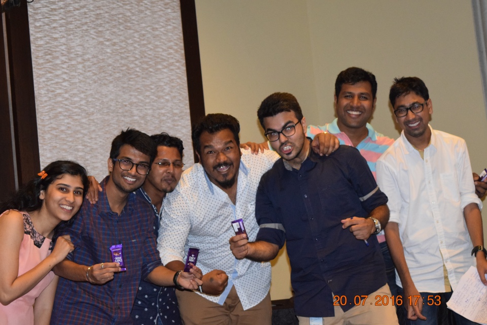
Team Outing at Corianthans Club Pune
It has been four years & eight months in the IT career and during all this time heard a lot about one thing that is team outings & when outing word comes any where I am the most excited person, as I love travelling & exploring new places. This time with my new team of 30 people we went to the Corianthans Club Pune. Almost 10 KM form Magarpatta City office near NIBM road Kondhwa Pune. Its beautiful property to chill out & enjoyment.


So as decided by managers on 20th July after 12:00 Noon meeting we will leave from office to outing place. That day morning we all came to office early in the morning as we need to have at least 4 login hours. Everyone that day was with smiling face & waiting for the party time to come. In this way finally at 12:30 PM we all left from the office & reached venue around 1:15 PM. After reaching there we had delicious starters & soups. At the same time we had some group pics in the banquet hall & in resort area too. A while later we had our lunch too, till we all finished with our lunch it was 4:00 PM in clock.


Actual fun started after that & had lots of enjoyment in it. Outing organizers Mohit & Jayaprakash started opening one after other surprises for all of us. As it was rainy day out there then also they beautifully managed all activities for us all. Initially they handover-ed one paper to each person present there. It was like fill in the blanks but with the name of any team member. On that paper some adjectives were mentioned like Most Beautiful Lady in team, Angry Young Man, Cool Dude, Famous Personality, Enthusiastic Person, Rotlu of Team, Silent Person, Don of ERU, Helping hand like this almost 20 adjectives were there. After 10 minutes they collected those papers from us.


Later both of them announced the second game & that was Housie. Most of us were not that much aware of this game so we asked to explain it first before starting so Mohit & JP explained it nicely.
In this game any number of players can play. Each player will have a ticket with random numbers of (any between 1 & 99) in 3 rows.. We organizers have some coins printed from 1 to 99 on them.
How to play:
We will pick one coin at a time & will announce it aloud…
The players who have the number in their tickets, will make a note of it…
Its HOUSIE if you mark all the numbers in your ticket before any one else does..
Also you can play for First Row, Second Row & Third Row.
It sounded interesting & we all started playing it with very much energy & passionately. Everyone was eagerly & with full attention listening the numbers announced by organizers. In such way some comments in between were (bhai maine kya paap kiya mera to 1k bhi number nahi lag raha) , (mera ho gaya mera ho gaya jake ke dekha to column hua hai not row…hahaha), (some one was asking agar single number bhi nahi aaya to use bhi gift hai kya). In such way finally Nirmala got her HOUSIE & declared as winner.


Later organizers came with very creative & full team effort game. I don’t know the name but it was very enjoyable one. As per our available people count, we made five teams each with 5 participants. four will play the game and one will monitor for any cheating is going on there or anything else but monitoring for different team. It was very awesome & lovely team building activity. In it Ishwar’s team declared as winner as they completed the task at first.

Then after best ever game started & it was none other than Musical Chair. For that our DJ was Apoorva & Mohit was looking for the arrangements later he got busy in 1st games result & I took over his part in that game. In this way after eliminating one by one last five participants remained in the game was Ishwar, Aditya, Nirmala, Vaibhav & Piyush. Finally after eliminating remaining participants Ishwar become the winner in it.


Finally all the winners of adjective game & musical chair got the prizes one by one with sweetness & lots of love. Later all we get served with tea & break for few minutes. Suddenly our DJ started the Dhating songs & we all got attracted towards it & started dancing with full of madness. In this way how time completed no one noticed & it was 7:00 PM. At last one sweet surprise were waiting for us & it was small but sweet gift of Happy Man Statue.


After that we had some group pics outside the hall in resort property & left the place by taking beautiful memories of that day with us.


Kataldhar Waterfall Rappelling (450 feet)
On 30th July 2016 for the first time with Sahyadri Outdoor adventure group went for one of the deepest & awesome waterfall rappelling in western ghats that is Kataldhar near lonavla also known as Horse Shoe Waterfall. We left Pune at 7:00 AM & reached the destination Fanasrai village at 10:30 AM after travelling 72 KM distance. It was full rainy day there, while covering last 12 KM from lonavla to Fanasrai need to go via rajmachi trek route. It was disgusting road all of mud, rocks & full of rain water though drivable. In monsoon lots of groups use to do rajmachi trek & suddenly I mate with one of my best buddies on the way from Man Vs Miles i.e. Snehal Dongre & Rohini Kakkad. When we reached at camping place one of the villagers family in stall prepared the breakfast for us which is “Garma Garam Wada Pav & Tea”. There we filled our empty stomach with as many as Wada Pavs.


Then after we all headed towards the rappelling point, to get on the exact foot way need to get back little bit on the road & enter in the forest by taking right turn. Heading on that foot way first need to cross on small water flow but quite slippery these days, beautiful over bridge placed to cross this water flow. Little bit ahead there is awesome place for camping & all; adjacent to that another food stall is there. From there on right side we entered in the forest again & while descending that small hill, which is very much slippery these days so need to be very careful.


After 15 to 20 min descending we reached the point from where we will rappel down. Valley view from there is simply awesome; we all were in full of clouds. Waterfall coming from the top of the hill has direct steep way there to get down; going ahead it will mix up with Ulhas River. We did the rappelling on that steep way of waterfall. Experience of doing such big rappelling was terrifyingly hilarious. From there first participant rappelled down at 12:00 noon & after that one by one everyone was going down, average time to get down & pull rope back is 20 minutes. So we got time to rove around there & have amazing snaps in waterfall, but be very very careful while walking in waterfall because one step failure will cost your life.


We all enjoyed a lot in that waterfall & had group pics there. Till my turn comes to rappel down it was 4:00 PM in afternoon, so I got hungry again. Organizers had taken “Theple, Chatni & Tomato Sauce”. Finally my turn came & after checking my harness is tight enough I started rappelling down the waterfall, at the start it was as usual rappelling, on the midway I took 30 sec rest as it was quite energetic to pull the rope & lift up. There I turned a little bit & locked the wonderful valley view in hanging state. From there I used the hopping steps to get down which I saw in Man Vs Wild. Then at the end I took another 30 sec rest & step down in normal way & reached at the base. I took almost 7 minutes to get down, after releasing the rope heading little bit down by walk we reached the semicircular shape of hill formed due to waterfall. There exactly below the waterfall we had few minutes, while going there please wear the helmets, because you are not aware what may come in waterfall on your head, sometime it may be a small rock or tree branch. After having lots of fun there we headed in left direction of that waterfall & took rest in cave.


From there to get back to the camp need to do the one and half hour jungle trek, which we started at 6:30 PM. At the start going in left direction we reached the place to get down from that hill, from there take left turn through forest. In that forest I saw too many crabs o every single step there was at least 4 to 5 crabs were there so be careful for you as well as for their life. When those crabs were running on ground it was looking cutest, one thing I noticed if they were not able to find the place to hide their self they used to spread their claws in angry look. I don’t know the types of crabs but at least I know the color I found three color crabs there white, brown & orange. Also keep your eye on the way for proper orientation like red ribbons are tided on correct route, small small rock towers are created for right directions, paint markings are drawn on the rocks, on trees for proper directions. If you missed some where search for it.
Finally we reached the rajmachi trek road at 7:30 PM & in next few minutes reached the camp place, where delicious dinner was waiting for all of us. There we had “Garma Garam Bhakri, Aalu, Matki, Papad, Rice, Dal, Achar, Onion”. At 9:00 PM we started back travel to Pune with lots of fun antakshari & all. Finally our trek comes to an end at 10:30 PM. Thank you thank you thank you so much Sahyadri Outdoors for such thrilling event.
Note:
- Photo Credit to Rahul Chandure.
- At rappelling point check harness, helmet & hand gloves properly.
- Be careful while walking in waterfall & in forest.
- Go in full sleeve cloths, also have extra pair of cloths.
Torna Waterfall Rappelling
After Aashdhi Ekadashi on beautiful Sunday (17th July 2016) morning with Apex Adventures, I went to the waterfall rappelling event near Torna Fort Base Village Velhe. This waterfall rappelling point is few minutes away from village. After picking up all participants, we left the Pune at 7:00 AM & reached there at 10:00 AM & the instructor Akshay Gokhle came there to guide us all. All together there were 70 members, 30 from our group 30 from other group & 10 instructors.

It was the wonderful day out there greenery all over the place, beautiful waterfalls & like icing on the cake slightly raining was there. To reach that point of waterfall rappelling, we crossed two small water flows & one beautiful waterfall on that flow. We enjoyed there a lot while coming back.


At rappelling point Akshay given us all the instructions & said to come one by one for amazing adventure. There was two ropes to get down through waterfall & both were properly fixed & two instructors at the top two at down to help us all for rappel down & two instructors were helping us to fix the harness, helmet & gloves for our safety while rappelling down. Don’t go at the edges of the waterfall it is very slippery so be careful.


Beauty of plateau was enhanced because of mysteriously attractive white flowers. Later I was searching for proper place to click snaps of all participants while doing rappelling. While searching for those places we found one small engaging waterfall. There we had few clicks & decided three places to click the snaps one at the top second at the mid way of plateau & last one at the down.

Then one by one all the participants started one of the thrilling event of their life waterfall rappelling. The faces of the guys at the start was very nervous, full of tension was looking on there faces, they were asking so many queries to the instructors available there like what is the safety level? how to get down step by step? & so many they were asking questions like child. Those who were in between the waterfall while getting down & we all were encouraging them to go ahead. At the end gorgeous smile on their faces was showing their joy, happiness for some kind of achievements in life. Some one was telling me can we do it twice please please, some one was asking me for more such kind of adventures. I can see the tremendous joy and freedom in their eyes after spending an enthusiastic day, it fueled all of us with happiness, courage & fight our daily small small challenges with smile on face.


Thank you thank you thank you so much Akshay Gokhale & all free lancers for guiding us. Also many thanks to all participants to share this delightful day with me.
Note:
- Photo Credit to Rahul Chandure, Amol Kotkar.
- Go in full sleeve cloths, also have extra pair of cloths.
Lohagad-2016
This time with newly made friends at work, due to their interest & continues force to arrange some trek & plan all things in it, I said fine lets go for outing on 6th July 2016 as we have holiday. Almost ten odd people agreed on it & I planed the trek to LOHAGAD. After chit chating a lot on travel, food & time arrangements, we all finally decided to go by Pune Local Train at 8:05 AM. For that also we had lot of calls & messages to wake up all who are coming, for god’s sake train got late 8 mins & we all caught it & reached the trek starting point that is Malvali Station. Actually all this guys were new to trekking so I asked take local transport (60/- Rs each) to reach base village that is 8KM from station. Also if you want to go Bhaje Caves on the way 2KM from station they will take 20/- Rs each. Then all guys said no no we will go by walk, let’s do trek from here itself. So after having breakfast of Pune famous hot-hot Wada Pav & Tea, we started walking at 10:15 AM.


Lohagad (Iron Fort) is part of the Western Ghats, it is 3389 ft above sea level. Lohagad has a long history with several dynasties occupying it at different periods of time Satavahans, Chalukyas, Rashtrakutas, Yadavas, Bahamanis, Nizams, Mughals & Marathas. Shivaji Maharaj captured it in 1648 CE, but he was forced to surrender it to the Mughals in 1665 CE by the Treaty of Purandar. Shivaji Maharaj recaptured the fort in 1670 CE and used it for keeping his treasury. This fort was used to keep the loot from Surat. Later in Peshwa time Nana Phadnavis used this fort for living for some time and built several structures in the fort such as a big tank and a step-well. In the recent years the fort has been declared as a protected monument by the government.
One more thing during all the way we enjoyed rain a lot, at last we all were fade up with it & trying to save our self from rain 😛 😛 :P. After walking on the concrete road for few mins we reached the Bhaje Caves & big water fall there, we all had few clicks there & resumed our walking then we mate another water fall there also we had some group pics. After walking for few more mins small ghat started, so while going up by road we took shortcut through forest & went up, but be careful while taking short cuts because it will lead you to valley directly & also you may get lost there. During all this way after few distance there are small small huts are there & you can get snacks, tea & drinking water there. When we reached at the top of ghat we again had few snacks like egg & cucumber. Then few mins later we reached the base village Lohagad, there on hotel Sai Vihar we ordered the afternoon lunch(Zunka Bhakar) which we had after getting down from fort.


12:30 PM we started ascending the fort from base village from the start itself beautiful stairs were constructed to reach the first entrance gate of fort called as “Ganesh Darwaja“. After entering through that beautiful door one can see the bastion remnants, on the right side there is a shilla lekha in very bad condition may be in coming few years it may vanish. There on the right there is small entrance to enter into man mad room structure in bastion. From the start of stairs you can see the cannons (toof) of chatrapati shivaji maharaj’s era, we saw total six cannons on fort. Due to holiday it was too crowded but scenic as well, after one more gate there are two caves which were used as Food Store Room(Dhanyache Kothar) , now a days both caves are full of water. Few stair steps are loose because of heavy rain, few steps are slippery too & few steps are beautifully created in the hill rock itself. Finally after crossing three more gates we reached the “Hanuman Darwaja” one of the beautiful attraction on the fort & proof of great engineers & constructors. When you go up from the stairs then you can not see it directly you need to take turn to right side almost 70 to 90 degree on top of that huge nails are placed on gate door all the gates are constructed in the same way on the fort but designs & carvings on every door are different.


At the top of fort huge fog was there literally we were in full of clouds, in such a way that beyond 10 meters nothing is visible even if somebody calls you from 20 meter that voice will not come to you that dense fog was there. At the start there is RajaRani Temple was the in that temple two tombs are there. We clicked some pics there & suddenly all fog gone & we saw beautiful top view of full stair case. There heading in right direction one can see the remnants of Rajwada, Sadar & base of homes, little bit ahead there are three very big big caves are there one is almost vanished other two are good in condition all were used as Horse Stable (“Ghodyachi Paga”). Going forward in that direction there is Dargha was there adjacent to it small lake was there & from this side of fort one can see the “Visapur Fort” clearly.


Little bit ahead in left direction from there, we reached the “Vinchu Kada” one of the beautiful attraction on fort in fact in Sahyadri Ranges. Its full of railings & secure now a days but be careful while going there. While getting back to main gate from other side of fort there is very beautiful step well was there, little ahead to it there is Mahadev temple was there & Tryambak Talav was there, few of us did swimming there, but be careful while doing it. After exploring all these things we started descending the fort & reached back to the hotel for lunch at 3:30 PM. There after having lunch by taking local transport we reached the Malavali station at 5:00 PM & took the 5:33 PM local tickets & reached back to Pune at 7:00 PM.


Note:
- Photo Credit to Mohit Umalkar, Purvesh Mandhalkar, Apurva Sherke, Khader Hussain, Rahul Chandure.
- Before going on trek do some research about the routes & what to explore there.
- Go in full sleeve cloths, good shoes,enough water & also if going in rainy season have extra pair of cloths.
"Bhivgad / Bheemgad & Spontaneous Decision Of Doing Kondane Caves"


Note:
- Photo Credit to Rahul Chandure .
- Before going on trek do some research about the routes & what to explore there.
- Go in full sleeve cloths, good shoes & enough water.
"रायगड आणि शिवराज्याभिषेक सोहळा" (Chatrapati Shivaji Maharaj Coronation Program)


- Photo Credit to Rahul Chandure & Ankush Shinde.
जय शिवशंभो !!!!
धन्यवाद !!!!
राहुल चांदुरे !!!!
